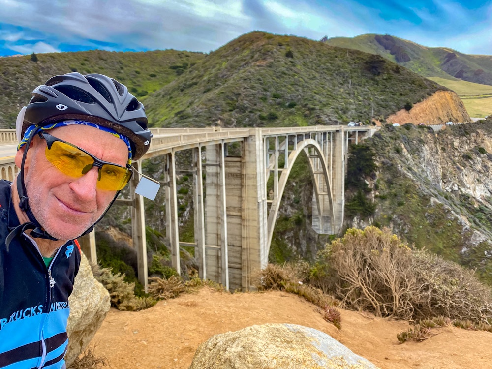
I woke up early and got packed then had breakfast of a chocolate muffin and half day old bologna. The muffin was really good and the bologna not so much. It was time to tackle the second half and finish off the Big Sur passage through the north.
If you’ve ever had the opportunity to drive Highway one through Big Sur you know how spectacular the roads, bridges and cliff views of the Pacific Ocean are. By Bicycle, it’s that and so much more. A slower pace allows you to view and appreciate all the scenic vistas and small details of the route.
However going by Bicycle has some extreme challenges tied to it. First off there’s lots of climbing. It seems like a constant cycle of hills where you go up 400 or 500 feet then back down to 100 feet. Do this and repeat and repeat and repeat. Secondly, there can be quite a bit of traffic and the roads are very narrow. I did find that most people were courteous, slowed and gave you plenty of room.


Today continued with no mobile phone service. In total, it was probably a black out zone of 80 miles or more. Also food and convenience stores are very scarce to nonexistent. You definitely want a good supply of water and food when passing through this area by bike.


I was very lucky because I got an early start, so there were very few cars for the first couple of hours. Also there was no wind to speak of for the first half of the day. At around mile 35, the wind “appeared” out of nowhere and faced me head on. The intensity of the headwinds were similar to what I experienced the other day but this time the hill climbing was added to it. The winds were gusty which added to the difficulty because as I compensated, it would throw me off balance and the bike would swerve as I tried to correct the steering. I estimate the winds exceeding at least 25 mph.


I endured and pressed on reaching the outskirts of Monterey and sought refuge at a subway to replenish my energy with food and upload the blog from the previous day.

Now all that was left was another 500 or 600 feet of climbing to reach Veterans Memorial park near Monterey. It’s one of the few non state parks which has accommodations for a hiker or biker.

This was a very difficult day of riding but also one that was really enjoyable at the same time. I will always remember this day. Now I have to rest tonight, figure out how far and how difficult tomorrow’s ride will be.
Ride summary: 9/10 difficulty, 65 miles with 5608 feet climbing. Mostly clear with times of fog and 70s and 80s temp but high wind chill at times. Calm first half, then extremely heavy headwinds. Today’s ride detailed GPS. Tour totals: 836 miles (46 / day). 48,068 climbing feet.


2 responses to “Day 18 – Bicycle Touring Plaskett Creek SP to Veteran memorial Monterey. Big Sur, big climbs, more wind.”
It’s easy to forget how beautiful and spectacular parts of California are. I think that the pictures you have captured of this ride are some of my favorites of your ride thus far; Classic California coast and famous waterfalls.
The mapped ride really shows how dynamic it was too. You can also see how midway through your ride you became very exposed to that northerly wind.
Very nice account. Thanks.
Yes, very spectacular and not really able to completely capture in some pictures. When I get home I will work on some panoramas and all the video I’m taking as well. I will look at the ride details, but I could really feel my average speed dropping. It was a real grind at the end.